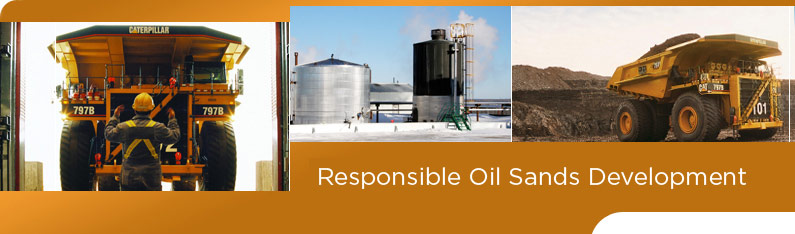
The Current Situation

Fact: The population of Fort McMurray and the Wood Buffalo Region has grown substantially and quickly.

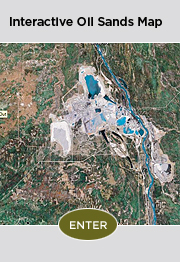
  • The Regional Municipality of Wood Buffalo is the largest municipality in Canada.  At more than 68,000 square kilometres in size, it is larger than the province of Nova Scotia.
  • Fort McMurray and Saprae Creek’s permanent population has doubled over the last decade to approximately 73,227.
  • In 2011, the region has hosted over 30,185 mobile workers in camps and lodges which are located close to oil sands projects throughout the municipality.

Fact: The region is connected by two highways, a railway and air service.

  • Fort McMurray is accessible via Highway 63, a single-lane highway with some twinned sections and Highway 881, a single-lane highway with no twinned sections.
  • A freight rail service extends from Edmonton to the Lynton rail yard south of Fort McMurray.  The oil sands projects north of Fort McMurray and many to the south are not connected to the line.  Goods sent to and from the Lynton yard must be unloaded and trucked.    
  • Fort McMurray is serviced by a municipal airport located 16 kilometres south of the city that accommodates commercial and private flights.
  • Some OSDG member companies have private airstrips to service their workforce needs.
  • Highway 63 is the main highway used to travel the 450 kilometres from Edmonton to Fort McMurray. 
  • Highway 881 can be considered an alternate route to Edmonton and other northeastern Alberta communities such as Lac La Biche, St. Paul and Cold Lake.
  • Highway 881 is used less than Highway 63 but is an important connector to communities such as Anzac, Janvier and Conklin which are located close to current and future in-situ oil sands projects.

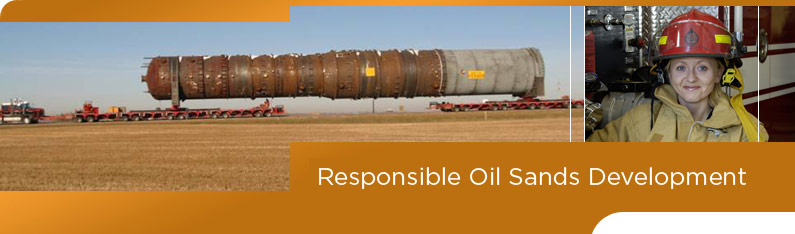
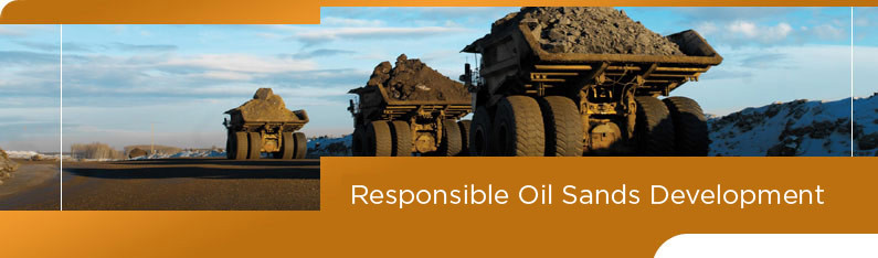
Fact: There are extraordinarily heavy transportation loads and traffic volumes in the region.

  • Highway 63 carries the highest tonnage per kilometre in the country.
  • Highway 63 accommodates the largest and heaviest loads ever carried on highways anywhere in the world.
  • Tens of thousands of residents and workers use Highway 63 and 881 to move between work sites and communities. 
  • Many workers commute regularly to the region from locations across Canada.

Fact: Transportation priorities have been identified and are being addressed.

  • Improved traffic flow in and around the Wood Buffalo Region is considered a high priority by residents, industry and governments.  Easing mobility in the region improves quality of life and the efficiency of oil sands development.
  • Alberta Transportation has announced approximately $1 billion in funding for future transportation projects in the region and is executing an additional $600 million in current transportation projects.
  • Several oil sands developers are investing millions in coordination with the Government of Alberta to better link public and private roadways to improve safety and efficiency.
  • Several companies have also invested millions on private aerodromes and airstrips to provide workers with safer and easier access to remote work sites.

Facts sourced by Oil Sands Developers Group (October 2009).

Sources for all facts available upon request.


Transportation

Did you know...

Canada’s oil reserves are second in the world behind Saudi Arabia

Of 179 billion barrels of Canada’s oil reserves, the oil sands represent 97 per cent

For each permanent oil sands-related job, nine additional direct, indirect and induced jobs are created in Canada.

Currently 240,000 jobs in Canada are directly or indirectly linked to the oil sands.

Between 2000 and 2020, oil sands development has the potential to generate at least $123 billion in royalty and tax revenues for Canada’s federal and provincial governments.

The oil sands currently account for only 4.6 per cent of Canada’s greenhouse gas emissions. This is less than 0.1 per cent of total global emissions.

Alberta was the first jurisdiction in North America to legislate industrial greenhouse gas emission reductions.

Producers have made great strides in reducing the amount of emissions per barrel of bitumen extracted from the oil sands. The equivalent of 2.6 million tonnes of reductions have been made – the same as taking more than 550,000 cars off the road.

The province of Alberta has committed $4 billion toward climate change initiatives, including $2 billion for public transit and $2 billion for carbon capture and storage (CCS). This is the largest CCS investment in the world.

Air quality around oil sands operations is better than all North American cities reviewed by the Alberta Clean Air Strategic Alliance.

Alberta air quality standards are the most stringent in Canada.

Air quality in Fort McMurray is monitored around the clock. Results are available at the WBEA site.

Air quality has been extensively modeled and demonstrated to remain within Alberta’s strict air quality guidelines even with all projected oil sands development in place.

Oil sands are located below the surface of 140,200 square kilometres of land, 4.5 per cent of Canada’s total boreal forest.

Mineable oil sands only exist under 0.1 per cent of Canada’s total boreal forest.

While disturbance is occurring daily, in more than 40 years oil sands mining has disturbed about one hundredth of one per cent of the Canadian boreal forest – some 500 square kilometres.

Since 2001, coordinated efforts between government and industry through Integrated Landscape Management (ILM) activities have reduced land surface disturbance in the region by 20 per cent.

As required by law, and included in all project approvals, reclamation work is ongoing and continuous in the oil sands. All lands disturbed by oil sands will be reclaimed.

Mining is only an option for oil sands that sit less than 75 metres under the surface.

More than 80 per cent of the oil sands will be developed using in-situ technologies.

In-situ projects resemble conventional oil development and do not require tailings ponds, or mine pits.

In-situ operations create linear disturbance of the surface for wellheads. But new technology and processes, including low-impact seismic and directional drilling, are reducing that footprint.

In Alberta, Alberta Environment regulates oil and gas industry water use under the Water Act. Oil and gas companies are subject to the same conditions for use as any other licensed water user in Alberta.

Currently, the oil sands industry draws less than half the water allocation allowed by Alberta Environment from the Athabasca River.

Water allocations are strictly controlled during low flow periods.

More than 80 per cent of water drawn by industry from the Athabasca is recycled.

Non-potable water which is unsuitable for drinking, livestock or irrigation use is used wherever possible for in-situ production.

Alberta Environment prohibits the release of any water to the Athabasca River that does not meet water quality requirements.

RAMP, a multi-stakeholder body, conducts annual monitoring of the river’s fish species, fish habitat and water quality. The monitoring has not detected significant changes to the Athabasca River. www.ramp-alberta.org

Bitumen from exposed oil sands along the river banks has seeped naturally into the Athabasca River as it cut its way through the landscape.

Tailings contain the water, residual bitumen, sand and clay that is left over when the bitumen is separated from the sand.

In the ponds, the solids separate from the water so the water may be recycled into the process again. Of the total water used by oil sands mines, 80 per cent is recycled.

During and after mining, the tailings ponds are reclaimed. No tailings water is released to the Athabasca River or any other watercourse.

The first tailings ponds will be reclaimed in 2010.

80 per cent of the oil sands resource will be developed using in-situ technology which does not require tailings ponds.

More Facts